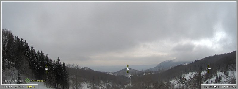
Atmospheric observatory at Otlica
Otlica is part of the Virtual Alpine Observatory (VAO) - a network of European High Altitude Research Stations based in the Alps and similar mountain ranges with the goal to join forces and resources to address in scientific problems relating to the atmosphere, biosphere, hydrosphere and cryosphere systems.
Virtual Alpine Observatory is active since 2012 and includes partners from Austria, France, Germany, Georgia, Italy, Norway, Slovenia and Switzerland.
Meteorological and Environmental Monitoring
The Otlica observatory as a node in the national network for environmental monitoring of the Environmental Agency of the Republic of Slovenia (ARSO) continuously provides a number of meteorological and environmental measurements, used both for operational weather prediction by ARSO and for research and teaching by UNG. Environmental station at Otlica serves as a test case for the future monitoring network in Slovenia. It provides wind, precipitation, temperature, humidity, solar irradiation and ozone data.
Stratospheric research
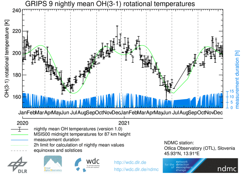
In collaboration with the Earth Observation Center (EOC) at the German Aerospace Center (DLR), Otlica observatory participates in the Network for the Detection of Mesospheric Change (NDMC) program investigating the mesopause region (80-100 km) with the goal of early identification of climate changing signals. NDMC is affiliated with the Global Atmosphere Watch program of the World Meteorological Organization and with the Network for the Detection of Atmospheric Composition Change.
NDMC scientific goals are aiming to:
- Identify and quantify climate changes by monitoring key parameters such as temperatures in the mesopause region, airglow brightness for the early characterization of climate signals
- Identify and quantify variability at different time scales such as seasonal variations and solar cycle effects
- Detect solar activity effects at all time scales (“Space Weather”)
- Provide answers to other scientific questions related to atmospheric dynamics at different time scales including the description and the causes of the variability of periodic and quasi-periodic processes
At present, Otlica observatory hosts one of the Ground-based Infrared P-branch Spectrometer instruments (GRIPS) in the NDMC network.

Light pollution measurements
Light pollution is excessive, poorly directed or unnecessary artificial light at night, which affects the natural day-night/light-dark cycle and obscures the view of the star-filled sky. Otlica observatory is one of the sites for the STARS4ALL project hosting a TESS-V1 photometer provided by Universidad Complutense de Madrid.
The brightness of the night sky in the zenith is described in terms of magnitude, a logarithmic measure of the brightness of an object in the visible spectrum, commonly used in astronomy. Larger magnitude means less bright source, in our case darker sky. For comparison, the magnitude of Saturn is 0 and that of our closest star Proxima Centauri is 11. Data for TESS no. 35 at Otlica is available from stars4all.eu.
Lidar
Aerosol transport in the troposphere and other atmospheric properties such as air-mass flow can be studied by lidar systems, which measure various types of backscattering of short laser pulses on aerosols and molecules of air. Otlica observatory hosts an 3D scanning Mie lidar operating at the wavelength of 1064nm, which provides information on optical properties of the troposphere above the Vipava valley, Karst plateu and the Bay of Trieste up to the distances of about 10 km from the lidar site.
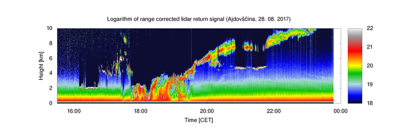
An example of the temporal scan using our Mie lidar showing the evolution of atmospheric structure up to 10 km above the surface.